This is a very nice place to visit. I have hiked most of it, enjoying all of the various areas. I personally like the St. Johns River side; the views of the river and cypress trees are just beautiful! The only real available access spot now is just off RT50, watch for the sign marking the area. Parking is pretty scarce, I assume because it is an area not that widely used. If I could change one thing, that would be to get rid of the helicopter training which were quite annoying during my 2008-2009 visits. It seems a school has an airfield right in the middle of the area and use it all the time. A fair percentage of the trails are actually roads leading out in different directions as you leave the parking area. You can head straight south and will eventually wind up at the St. Johns River floodplain with Paw Paw Mound on your right. You could take a right at the first crossroads and head down that road, after going through a gate and heading south you will come out again at the St. Johns River floodplain with Paw Paw Mound on your left. This route down to the river is normally the drier route, if it is still the wetter part of the year use it. If you want to go over to Addison canal and the Indian mound trail area, than look for the blue blazed trail just after entering the area on your left. You will follow the blue blazes (at times hard to spot) down to where you will find a log bridge which allows you to cross the Addison Canal. Look for the blue blazes and follow them over to the edge of Great Outdoors RV Park. You will then head south down into just about the only real wooded section in the area. You will find a loop trail that will take you around what is recorded as an Indian mound. So regardless of which way you go you should enjoy the area. As I mentioned, I have hiked most all of the trails and roads, as well as explored some of the areas which just had cattle trails cutting through them. I have run into some pretty big cows during my walks, but they just looked at me and let me pass. I feel they provide a great benefit to the area; the trails through the grass are great to find. The main problem and concern for me at all times are the hunters that show up along the St. Johns River. I hate to even mention hunters but I feel I would be amiss if I didn’t make people aware of their presence. I normally wear bright colors whenever I go into the St. Johns River floodplain.
Blazed trails - the only actual blazed trails start on the left side as you leave the parking lot. You start on a blue blazed trail, then see a white blazed trail which leads to a red blazed trail loop in the woods. In many areas the blazes are not that great; they are faded or even non-existent. If you don't spot a blaze, try and determine the way you think the trail should go and go that way - if a blaze is not encountered after a reasonable distance, go back and look around.
~ You can check the hunting schedule at my web calendar devoted to that – see
Hunting Schedule Calendar
~ SJRWMD has provided a PDF brochure and trail map at
http://www.sjrwmd.com/recreationguide/canaveralmarshes/
~ My hikes at Canaveral Marshes can be viewed/downloaded at -
My WIKILOC Hikes - just look for Canaveral Marshes Hikes in list
Here are some of the GPS coords for spots in the Marshes - use them in Google Earth Parking Area -
- N28 32.635 W80 53.791
- Paw Paw Mound - N28 31.252 W80 54.273
- Blue Blazed Trail Start - N28 32.637 W80 53.787
- Addison Canal - N28 31.642 W80 52.603
- Bridge Over Canal - N28 31.639 W80 52.869
- Indian Mound - N28 30.600 W80 52.400
- Helicopter Airfield - N28 32.161 W80 54.120
- Hunter's Camp - N28 32.190 W80 54.807
Here is a map of the area, showing some of my tracks –

Entrance Information -

Road/trail down to Paw Paw Mound -

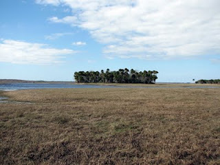
Paw Paw Mound -
Horses on the floodplain -

Some cattle looking at me - just lookers -

Cattle trail through the grass -

Cypress trees on the river bank -

Student helicopter in the area -

Power lines covering blue blazed trail -

Bridge over Addison Canal -

Blue blazed trail through the woods -


9 comments:
Great stuff, Tom. My family is hitting the Canaveral Marshes Blue Trail today. Thanks for all the hard work, labor of love. See you on the trails, Frog Man!
We did the blue blaze trail. The wildlife and birds were terrific. I am anxious to check this out next migration season, but the winter residents now are still great. Note, ... where you see a double blue blaze pointing to the right, do not take that right but continue straight. The actual turn to the right is just a bit further down the trail. The trails were maintained well on the section we were on. Thank you to the Saint Johns Water Management staff for answering some questions for us.
I hiked a bit of this trail today with my 6 year old. I only saw one blaze the entire time, on the main trail from the gate, halfway to the big intersection. It was a square nailed to a tree that I believe may have been blue but is now faded white. Without any blazes at the big intersection we turned back. From what I gather, we would continue straight to reach the st. Johns shore, then right to Paw Paw.
I noticed something cool on our walk. About midway to the intersection on the right you can see the remains of a tree fort in an oak. There are just a few boards remaining.
The trail system in so many of these areas have broken down, no longer maintained. As far as the marshes and so many of the areas around here, stay on old roads and you will see a great deal of what each area has to offer. About the Marshes, best to either go left at the intersection to get to the Addison Canal area or go right to get to the St Johns River area and Paw Paw Mound, going straight could lead to some very wet areas. I have hiked every section of the Marshes, but in many areas only in the dry season. As far as that tree house, that most likely was an old hunters tree stand.
Went on the trail early this morning rained last night so trail heading towards St John River about 3/4 was a bit wet, water up to almost my knees in a couple of area. Beautiful hike, saw looked like 3 black wild pigs crossing the tail about 50 yards Fromm me. Also saw a nude hiker that was out early as well. He was cool to talk too, no worries did not care that he was naked. Actually now that I think about it probably cooler on a hot morning and humid day. Next time I go I will turn right at the first crossing as might be dryer route. Happy hiking !
First, I'm afraid that area always gets very wet during Florida's wet season, I have hit water many, many times while hiking around the Marshes. As far as a nude hiker, now I have hiked many, many miles all over central Florida, running across just about what I though was everything, well as far as a nude hiker - never, happy about that ;-}
I will take your advice and take the dryer route next week. As for the nude hiker not worth reporting as he was not bothering anyone as I was the other person in marsh. I guess could say he was one with nature a naturalist. Clearly just enjoying the environment.
I'm not sure you will find a real "dry" route these days. I was in Tosohatchee the other day and and what are normally dry areas were very wet!
As far as the nude fellow, if exposing himself then he is breaking a law. I certainly have no problems with nudity, but only where it is actually allowed!
The road to the west is closed to the public. I'm not sure if it was always private and the owner(s) just left the gate open for use or not but the gate is closed with a no trespassing sign. From the parking area, yep, just walk straight and what a view of a river floodplain. I walked out took a right and then parallel to the river until I saw the Paw Paw mound. Can't miss it, its a circle of Palms where everything else is grass. My guess is the Indians made it for the wet season and used it as a familiar place to stop like a fishing camp, really cool that it is still there and now looks like a natural blimp in the wilderness. So I made it a loop anyways the private road is short and honestly I just hopped the fence, the fence out by the river is open. I think the owners cattle are out in the floodplain right now and I doubt they need much tending to while they are out there. Anyhow pretty short hike for some of the best views of the floodplain, a million palms, cattle roaming far and wide, some air boats, there probably needs to be an overlook somewhere. And omg the helicopters were non stop also for about an hour and then when I was finishing the hike another one flew over.
Post a Comment